
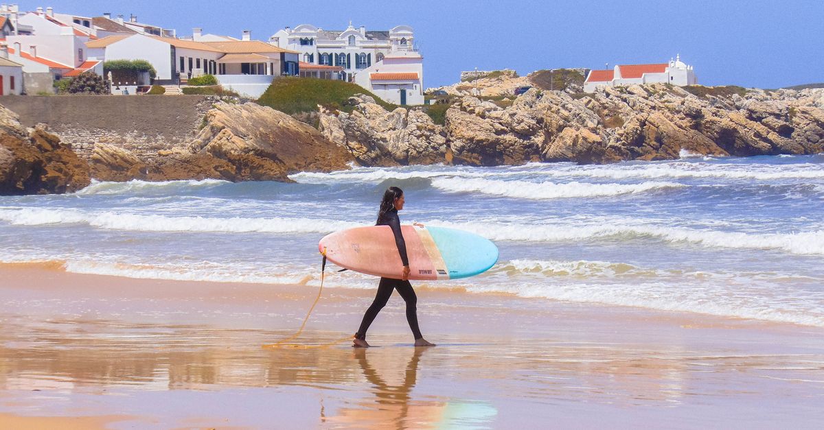
October 14th, 2023. Baleal Norte, 07:40. Water temperature 18.2 °C per the Copernicus nearshore cell,[1] a 1.4 m swell at 12 seconds rolling in from 295°, and a light NE wind that would make the north-facing beach mushy inside an hour. The three surfers already changing at the top of the ramp weren't heading north. They were walking south across the isthmus — 400 metres on foot — because Baleal Sul was cross-offshore under the same wind. Two beaches, one peninsula, opposite verdicts. That is the entire logic of this place, and it's what most Peniche guides never say out loud.
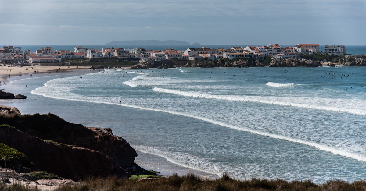
Baleal is a limestone knuckle sticking 4 km into the Atlantic at 39.37°N, joined to the mainland by a sand isthmus about 250 metres wide at its narrowest. The peninsula's near-circular geometry means beach faces point roughly N, NW, W, SW and S within a two-kilometre radius. Combine that with Copernicus SST, Open-Meteo wind climatologies, and NOAA/IPMA wave records, and you can answer a more useful question than "is Peniche good today?" — namely, "which face is good today, and why?"
This piece is built on that reframe. It's not a rankings list of the six best waves in Peniche. It's an argument that competent visitors read wind direction first and pick a spot second, and that the standard "Baleal = beginner beach next to Supertubos = pro reef" narrative is doing readers a disservice.
🧭 The peninsula logic: why aspect beats forecast-checking

- Aspect spread: ~180° of usable beach orientation within a 2 km radius
- Dominant winter wind: NE–N at 25–35 km/h[3]
- Dominant summer wind: NW afternoon thermal, 20–28 km/h[3]
- Isthmus crossing: ~400 m on foot between north and south faces
- Peninsula length: ~4 km E–W, ~1.2 km N–S
The mechanical claim is simple. When the dominant N–NW Atlantic groundswell arrives paired with a NE offshore wind — the most common winter pattern in the Open-Meteo climatology for the Peniche grid cell[3] — the south-facing beaches sit cross-offshore while the north-facing beaches take that same wind onshore and go to chop. Flip the pattern to a summer NW thermal and the arithmetic reverses: Baleal Norte cleans up, Baleal Sul blows out.
Locals internalise this without thinking. Visitors who check a single spot forecast and give up when it says "poor" are missing that a 15-minute walk across the sand puts them on a different aspect entirely. The peninsula is, functionally, a wind-direction insurance policy — one that a Nazaré-bound traveller doesn't have.
Aspect logic is a first-order filter, not a guarantee. Local bathymetry, sand movement after storms, and swell period all modify the outcome. We don't have high-resolution bathymetric change data for Baleal's beaches year-on-year — sand banks move, and no public dataset tracks them.
📍 The four main breaks and what they actually need
- Supertubos optimal window: 1.5–3.0 m Hs, 12–16 s, W–NW direction[2]
- Baleal Norte workable range: 0.6–2.0 m Hs, 8–14 s, tolerates NE wind to ~20 km/h
- Lagide: mid-tide reef, 1.0–2.5 m Hs, submerged rocks a genuine hazard at low water
- Molhe Leste: harbour-wall right, works on solid W swell; hollow, shallow, not for improvers
Supertubos is a shore-break sandbar over a reef base that produces the hollow left and right barrels featured on every highlight reel. Outside its narrow window — mainly W–NW swell in the 1.5–3.0 m range with a long enough period to hold shape — it closes out or goes fat. The Rip Curl Pro contest window sits in October precisely because that's when the swell probability curve and the period curve overlap most reliably.[2]
Baleal Norte is the opposite in character: a forgiving beach break that will produce rideable waves in messy, small-to-medium conditions and tolerates onshore drift better than any reef. Lagide, on the peninsula's exposed west face, is the intermediate reef most travellers underrate — a long, workable left over reef, best on a pushing mid tide, with real consequence at low water when the inside rocks come up. Molhe Leste, the harbour-wall right, needs serious W swell and is not a place to learn anything except humility.
The point isn't a podium. It's a decision tree. Ask what the wind and swell are doing, then match them to the break whose requirements they satisfy.
Sand banks at Baleal Norte and Sul shift significantly after major storm events (Hs >4 m). Our spot descriptions reflect multi-year averages; the bank configuration this week may differ from last month's. There is no real-time bathymetric monitoring for these beaches.
📅 Seasons: the honest version
- Peak SST: September, 18.5 °C mean (Copernicus 2015–2024, cell 39.35°N 9.33°W)[1]
- Trough SST: February, 13.8 °C mean[1]
- Highest swell probability (Hs >1.5 m): November–February, ~65% of days[2]
- Lowest swell probability: June–August, ~20% of days >1.5 m[2]
The binary of "winter epic, summer flat" is lazy. September–October is the statistical sweet spot: swell frequency and size are climbing from summer lows, water sits at its annual peak (18–20 °C after four months of solar heating), and the August crowd has gone home. January–February delivers the biggest average swell but also the highest storm-close-out rate and the coldest water — 13–15 °C SST, 5/4 mm wetsuit territory. July–August has the most reliable wind (NW thermal, on-schedule most afternoons) but the smallest swell: fine for longboarding, wrong for performance surfing.
The under-appreciated month is March. Water is still cold (14–15 °C), but crowds are thin, the winter storm tracks are weakening enough that Supertubos gets more clean windows than in January, and accommodation prices haven't started their April climb.
SST figures are for the Copernicus nearshore cell, not the actual surf zone. Upwelling driven by persistent N winds can drop surface temps 3–4 °C below the cell mean within hours, particularly in June–August. Open-Meteo does not model upwelling; Copernicus L3 SST has a 1–2 day observational lag.
🌊 The beginner question: Baleal is not automatically safe

- Cantinho da Baia usable-for-beginners ceiling: ~0.8 m Hs (fetch-limited, peninsula-sheltered)
- Rip current elevation at Baleal Norte: during W–NW swell above 1.2 m
- Licensed surf schools in Peniche municipality: 14 as of 2023 (IPDJ registry, verify current)
- Beach flag authority: Autoridade Marítima Nacional (AMN)
The received wisdom is that Baleal is a beginner beach. That's partly true and partly a marketing claim that doesn't survive contact with a 1.5-metre W swell. Cantinho da Baia, the sheltered lagoon-side of the isthmus, is genuinely low-consequence in small conditions — the peninsula blocks the open ocean, fetch is limited, and waves rarely exceed knee-to-waist height. It's where the reputation was earned.
But Baleal Norte and Baleal Sul are exposed Atlantic beach breaks. Above ~1.2 m Hs with a W–NW direction, they produce shore-dump and rip currents that are actively hazardous to a first-week surfer holding a foam board. "Beginner-friendly" is a swell-size-conditional claim, not a fixed property of the sand.
The 14 licensed surf schools clustered around the peninsula are, on average, competent — they read the same wind logic outlined above and move their groups accordingly. If your July booking gets shifted from Baleal Norte to Cantinho, that's the system working.
We do not have incident or rescue data for Baleal beaches. AMN publishes annual water safety statistics but not beach-level breakdowns. The risk framing here is based on break morphology and swell exposure, not on injury records. Absence of data is not absence of risk.
✈️ Getting there: what the route data actually shows
- LIS to Peniche: 85 km, ~75 min by bus or car
- OPO to Peniche: ~140 km, viable if OPO fares undercut LIS
- Bus operator: Rede Expressos, LIS Sete Rios terminal → Peniche (verify current schedule)
- Board bag surcharge: varies by carrier; check before booking
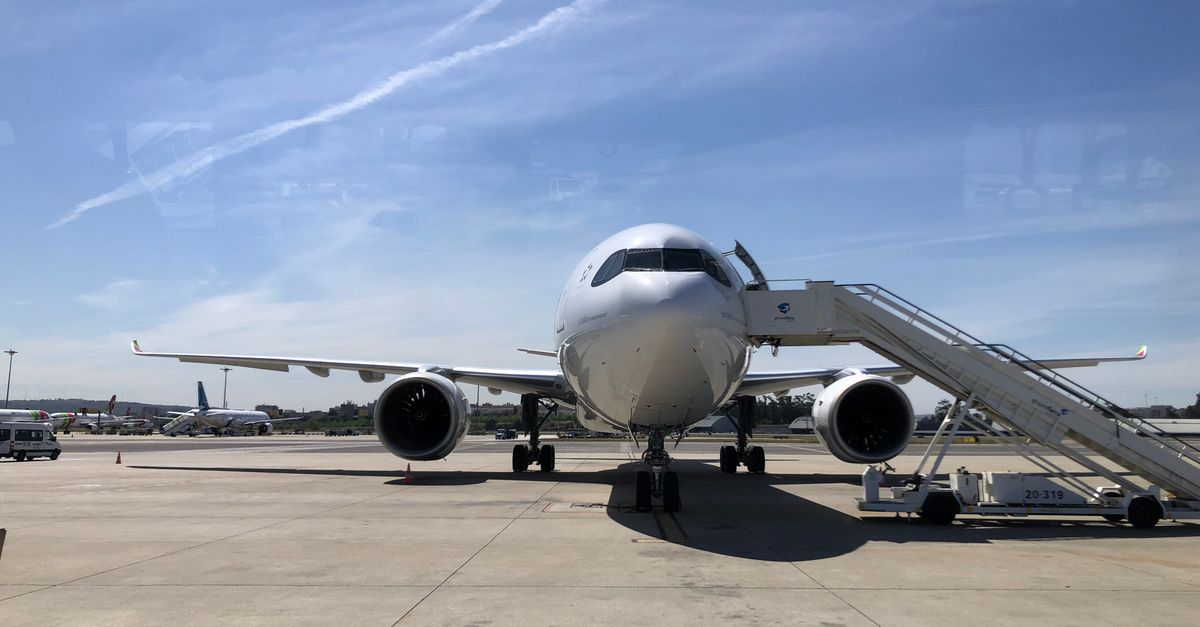
LIS is the default entry point and it deserves that status: it has direct service from most Western European capitals and multiple North American East Coast hubs, per the OpenFlights route database.[4] From LIS, the Rede Expressos coach to Peniche runs several times daily from Sete Rios and takes about 75 minutes; a rental car does it in the same time via the A8 with a small toll.
Porto (OPO) is worth checking as an alternative if you're flying from northern Europe. It's further from the peninsula (~140 km vs 85 km) but often cheaper on low-cost routes, and the drive down the A8 is straightforward. What you don't want to do is fly to Faro and drive — that's 400+ km and no real advantage over LIS.
OpenFlights route data has a known lag; low-cost carriers (Ryanair, easyJet, TAP seasonal routes) change on 6-month IATA schedules. Treat any specific frequency figure as indicative, not bookable. Verify direct with the airline.
📊 Crowds: proxy data, not headcounts

- Google Trends "surf peniche": August peak (100), secondary October–November peak (~65)[10]
- Oeste region accommodation occupancy peak: July–August[5]
- Rip Curl Pro contest window: historically October, drives a regional tourism spike
- Uncrowded window (inferred): weekday mornings, mid-November and early March
Peniche's crowd problem is real but unevenly distributed. Supertubos during a named October swell can hold 80-plus surfers in the water. Baleal Norte on a grey Tuesday in November can have fewer than 10. The problem is that nobody actually counts surfers in the water, so any confident-sounding crowd claim is inference from indirect proxies: search interest, accommodation bookings, surf school throughput.
The proxies converge on the same rough picture. August is peak everything — tourism, search interest, occupancy — and simultaneously the flattest surf month, which produces a nasty ratio of surfers per usable wave. October is the second spike, driven by the contest and by returning European surf travellers, but it also happens to be when swell is best, so density is at least matched by quality. If you want empty line-ups, the data points to weekday mornings in mid-November or early March at a break that isn't Supertubos.
There is no primary dataset that counts surfers in the water at Portuguese beaches. Everything in this section is proxy inference. Anyone claiming to know exact crowd figures for a given day is guessing.
🌡️ Wetsuits and the upwelling asterisk
- May–October: 3/2 mm
- November–April: 4/3 mm
- January–February cold-sensitive: 5/4 mm, booties recommended
- Booties for Lagide / Supertubos: November–February, rocky entries
- Upwelling risk months: June–August
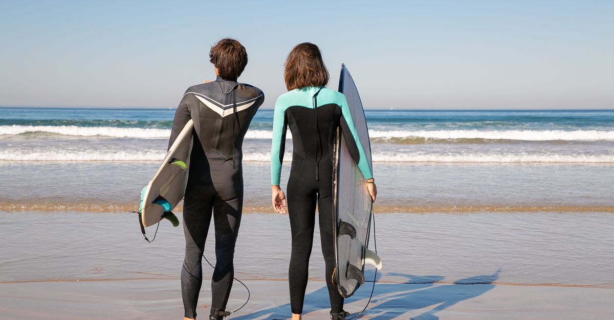
Wetsuit choice from the SST record is straightforward for most of the year. The awkward bit is summer. The Copernicus mean says 18–19 °C from July through September,[1] which reads as 3/2 mm territory. But persistent N winds during the summer thermal pattern drive coastal upwelling, and surface temps in the surf zone can drop from 19 °C to 14 °C inside a single tide cycle. If you're travelling in July and packing only boardshorts, you'll be cold half the time. A 3/2 mm covers both scenarios.
Booties are the other honest note. If you're surfing Lagide or the reef side of Supertubos in winter, the entries have exposed rock and urchin risk. Peniche town has enough surf shops that renting or buying on arrival is trivial — no need to check them from home.
Wetsuit recommendations here derive from SST percentile data, not from a standardised thermal comfort protocol. Cold tolerance varies. The 5/4 mm recommendation for January–February is conservative; hardened locals get by in 4/3 mm.
⚠️ What this guide deliberately doesn't tell you
- Sand bank state is unknowable in advance. Baleal Norte and Sul are sand-bottom beaches whose quality depends entirely on how recent storms have shaped the banks. No public dataset — Portuguese or otherwise — provides real-time or forecast sand bank mapping. A week after a big NW storm the banks may be excellent or completely washed flat, and no source we can cite will tell you which.
- Crowd figures are inference, not measurement. No primary source counts surfers in the water at Peniche or Baleal on any given day. Anyone quoting exact crowd numbers is extrapolating from search trends and accommodation data.
- "Beginner-friendly" depends on swell size, not on the beach's name. The Baleal-as-beginner-beach framing is accurate at 0.5–0.8 m Hs. It becomes actively misleading above 1.5 m, particularly during peak beginner-travel months (July–August) when a summer W swell can arrive without warning. We don't have the rescue statistics to say how often that mismatch produces incidents.
Spot a mistake, a stale route frequency, or a surf school count that no longer matches the IPDJ registry? Write to us at [email protected] — corrections with a citation get published the same week, and we'd rather ship an accurate second draft than defend a wrong first one.