
On August 14, 2023, a boat captain out of Puerto López radioed that the water at Isla Salango had dropped to 19 °C overnight — a four-degree swing from the week prior, triggered by a pulse of Humboldt upwelling pushing north along the Manabí coast.[1] Visibility that morning was six metres, the colour of weak tea. Three divers surfaced from the first drop with GoPro footage of a whale shark that passed close enough to count the spot pattern behind its gill slits.
That one morning compresses almost everything worth knowing about Isla Salango. Ecuador declared the 14 km² reserve around this volcanic islet a protected marine area in 1994, three decades before anyone in Quito was writing climate-adaptation plans.[2] What the brochures sell you is a species list. What the Copernicus sea surface temperature record and the OBIS occurrence database actually show is a site whose entire personality flips twice a year, driven by which current wins the tug-of-war offshore: the cold, nutrient-dense Humboldt from the south, or the warm Panama Bight countercurrent from the north.
This piece is a phenology guide dressed as a dive guide. We cross-referenced the monthly SST climatology for the grid cell containing Salango against OBIS megafauna records for whale shark, manta, hammerhead, and humpback — then checked the chlorophyll-a monthly means as a visibility proxy, since no public in-situ visibility log exists for this site. The answers are not symmetrical. Some months reward the trip. Some months punish it. The reserve's 1994 management plan addresses none of this.
🌊 The cold water problem nobody warns you about
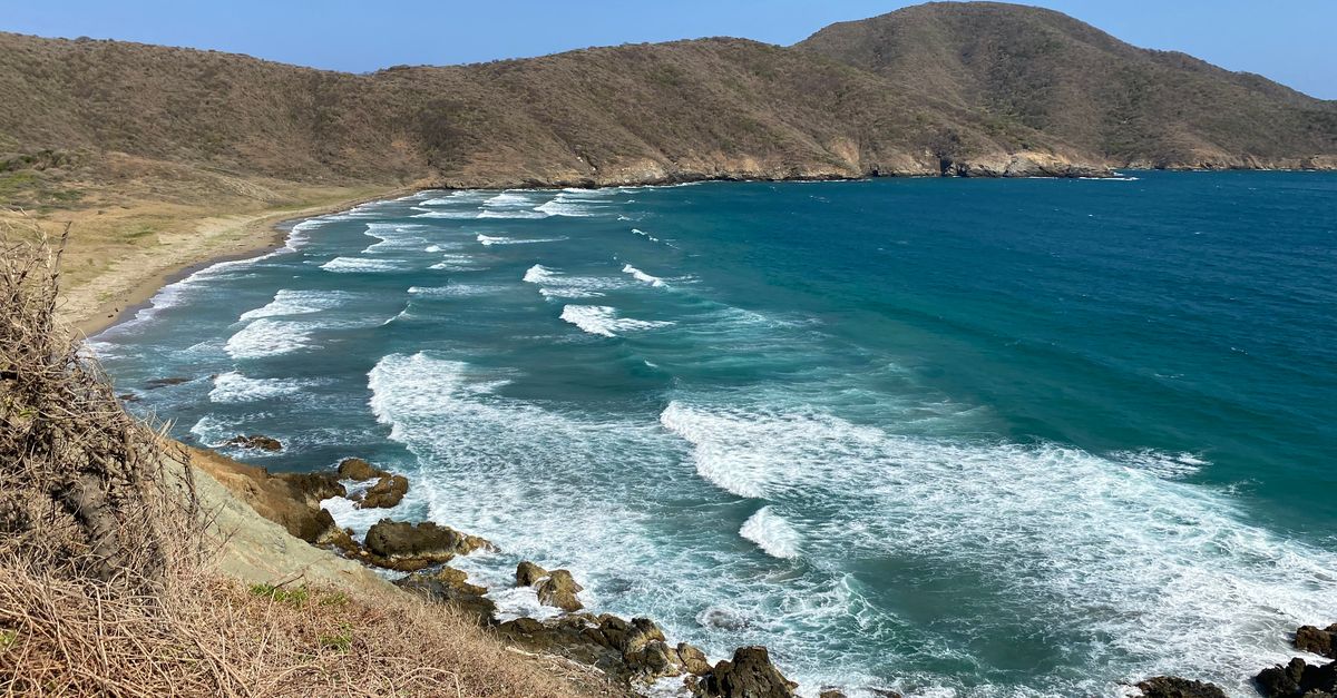
- Water temp range: ~18 °C (August trough) to ~27 °C (March peak)[1]
- Upwelling months: June–October (cold, productive, low viz)
- Warm-current months: November–May (clearer, less productive)
- Chlorophyll-a peak: July–September, inverse to SST
- Thermocline: typically 15–25 m, drops another 2–3 °C below
The Humboldt Current is why the Galápagos has penguins at the equator, and it is why Salango's August water looks nothing like the Caribbean. From roughly June to October, upwelling drives surface temperatures into the high teens and loads the water column with phytoplankton. Visibility collapses to five or six metres on bad days, ten on good ones. That same productivity is why the pelagics show up.
From November through May, the Panama Bight warm countercurrent dominates. Surface temperatures climb into the mid-twenties, visibility stretches to fifteen or twenty metres, and the water clears — because the food is gone. March divers see pretty reef scenes. August divers see animals they will remember for the rest of their lives.
Caveat: no public database aggregates in-situ visibility measurements for Salango. The chlorophyll-a proxy is defensible but imperfect. If a Puerto López operator kept a logbook, those numbers would be more accurate than ours — and nobody has published one.
🦈 When the pelagics actually show up
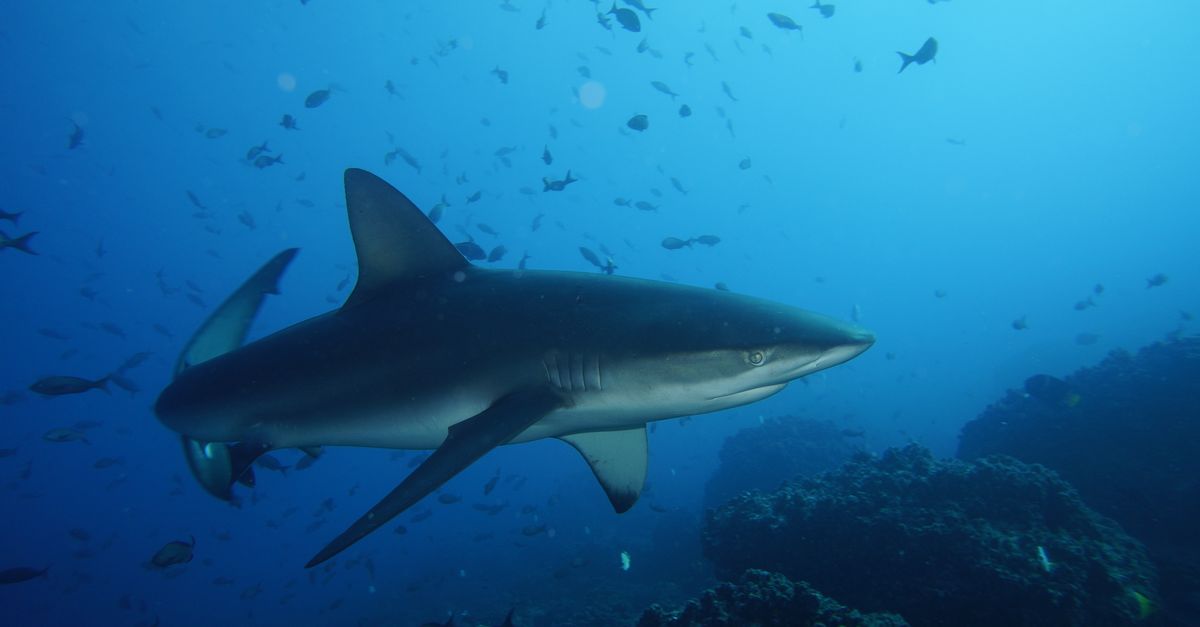
- Whale shark (Rhincodon typus): OBIS records cluster June–October
- Humpback (Megaptera novaeangliae): July–October migration peak
- Hammerhead (Sphyrna lewini): year-round at depth, schooling in cold season
- Giant manta (Mobula birostris): sparse records, no clear seasonal signal
- IUCN status (whale shark): Endangered since 2016[4]
The whale shark window at Salango aligns almost exactly with the Humboldt upwelling peak. OBIS occurrence records for the grid cell bounded by -2.1 to -1.6 latitude and -81.1 to -80.6 longitude are heavily skewed toward June through October, with August and September carrying the densest clusters. This is the trade-off made concrete: the water you can barely see through is the water the animals come to eat in.
Humpback whales use the Machalilla corridor — of which Salango is part — as a calving and nursing ground, with the aggregation period running roughly late June to early October. You will not usually see them from underwater, but surface intervals during this window are their own event. Hammerheads at Salango are a quieter story: present year-round at depth, but their schooling behaviour tracks the thermocline, which is sharpest in cold season.
Caveat: OBIS records for this grid cell are sparse before 2010. What looks like a "peak month" partly reflects when researchers were in the water. No peer-reviewed population estimate exists for Salango's reserve boundary. Treat occurrence histograms as probability hints, not forecasts.
🗺️ The reserve that time forgot

- Established: 1994, Ministerio del Ambiente decree[5]
- Area: ~14 km² around the islet
- Enforcement: no permanent ranger station on the island
- Documented pressure: artisanal fishing inside boundary per 2019 assessment[5]
- Protection class: reserve designation, not no-take zone
The 1994 decree drew a line on a chart. It did not fund a ranger station on the island, and it did not displace the artisanal fishing fleet based in Puerto López and Salango village. The Ministerio del Ambiente's 2019 assessment of the Machalilla protected area complex acknowledged ongoing extractive use inside the reserve boundary.[5] The management plan from 1994 predates any climate framework.
Species richness within the reserve grid cell, when you combine OBIS and GBIF records, lands in the low thousands of distinct taxa across all phyla — a defensible number only because it comes from aggregated occurrence databases rather than operator marketing. Compared with Islas Los Ahorcados 18 km north, which sits in the same oceanographic regime but has no reserve designation, the species-list differences are smaller than you would hope. Protection on paper is not protection in the water column.
Caveat: our enforcement data stops in 2019. Conditions may have improved or deteriorated. Divers should not visit on the strength of the "marine reserve" label alone — assume partial protection with ongoing fishing pressure.
✈️ Getting there: the GYE routing reality

- Gateway: Guayaquil (GYE), José Joaquín de Olmedo International
- Direct routes to GYE: MIA (American), BOG (Avianca, LATAM), LIM (LATAM), MAD (seasonal)
- Overland GYE → Puerto López: ~230 km via E15 Ruta del Spondylus, ~3.5 hrs bus (~$6), ~2.5 hrs hired car
- Boat Puerto López → Salango: 20–30 min panga
- Live-aboard infrastructure: none; day trips only
European travellers connect through Miami or Bogotá; Madrid-Guayaquil has run seasonally but should be verified against current airline schedules. From Guayaquil the realistic move is the overland transfer up the coastal highway to Puerto López, the only town with a working cluster of dive operators and panga owners who know the Salango boat approach. Manta's airport (MEC), 90 km north, has had limited international service — again, verify before booking.
Puerto López is not a resort town. It is a working fishing port with a strip of hostels, a handful of dive shops, and a seasonal rhythm built around humpback-watching tourism from July to September. Boat operations to Salango are weather-dependent and generally morning-only; afternoon winds routinely cancel second dives.
Caveat: OpenFlights route data has a known lag of 6–18 months. Our route list is a starting point, not a booking tool. Check airline sites directly, and build in a buffer day on the Guayaquil end for weather cancellations on the Puerto López panga runs.
🌡️ Gear decisions the SST data actually supports

- Cold season (Jun–Oct): 5 mm full suit at 18–21 °C surface
- Thermocline: 15–25 m depth, 2–3 °C colder than surface
- Warm season (Nov–May): 3 mm shorty adequate at 24–27 °C
- Viz cold season: 5–10 m — wide-angle, close-focus
- Viz warm season: 10–20 m — ambient-light photography viable
The marketing says tropical. The thermometer says Humboldt. In August a 3 mm shorty is a mistake; a 5 mm full suit with a hooded vest is the honest recommendation, and if your thermocline tolerance is low, a 7 mm is not overkill. Below 20 m in cold season the water routinely drops another two to three degrees, extrapolated from regional CTD data since no Salango-specific depth profile is public.[1]
For photography, the cold season rewards wide-angle lenses with close-focus discipline — you will be shooting pelagics at distances of three to five metres through particulate-rich water, and ambient-light portraits of reef life are not going to happen. The warm season flips this: longer visibility, cleaner water, but fewer big animals to point the lens at.
Caveat: SST means surface. Actual at-depth temperatures at Salango are not in any public dataset. The thermocline estimate is a regional extrapolation, not a Salango measurement.
📊 Salango in the Eastern Tropical Pacific corridor
- Cocos Island (CRC): 550 km offshore, liveaboard-only, ~$4,000+ per trip
- Hammerhead density: OBIS records show Cocos ~3–5× Salango grid cell
- Bat Islands (CRC): bull shark focus, similar upwelling seasonality
- Islas Los Ahorcados (ECU): 18 km north, same SST regime, less documented
- Las Catalinas (CRC): warm-season manta aggregation site
This is where honest comparison matters more than ranking. Cocos Island — Bajo Alcyone and Dirty Rock deliver hammerhead schooling densities Salango cannot match — OBIS occurrence counts for Sphyrna lewini in the Cocos grid cells run several times the Salango figure. The access cost is also several times higher: a Cocos liveaboard trip starts around $4,000 before flights.
The Bat Islands — Big Scare site operates on a similar upwelling calendar as Salango, with the bull shark aggregation drawing cold-season divers. Warm-season manta diving at Las Catalinas sits closer to the Panama Bight regime that Salango flips into from November onward.
The honest observation: a diver on a $1,500 total budget who can reach Puerto López overland from Quito gets more value from Salango than from Cocos. A diver with 200 logged dives and a $6,000 budget gets more megafauna density from Cocos. Both answers are correct. This is not a ranking.
Caveat: comparison is grid-cell to grid-cell. Within-site variation at Cocos (Alcyone vs. Dirty Rock) is larger than between some sites. Treat the numbers as rough shape, not fine ordering.
📉 What the SST trend line means for the next decade
- Regional ETP warming: ~0.1–0.2 °C/decade documented
- ENSO sensitivity: 1997–98 and 2015–16 events caused documented coral bleaching in Machalilla
- Upwelling intensity: suppressed in strong El Niño years
- Reserve management plan update: none publicly available since 1994[5]
- Attribution confidence: low — formal study does not exist for this site
The Copernicus annual SST record for the Salango grid cell since 1993 shows warming consistent with the broader Eastern Tropical Pacific signal of roughly 0.1–0.2 °C per decade reported by Vargas and colleagues in 2017. For a site whose entire ecological case rests on cold, nutrient-dense upwelling arriving reliably each June, that trend matters. ENSO events amplify the risk: the strong El Niño of 2015–16 caused documented coral bleaching in Machalilla waters, and strong Niño years suppress upwelling intensity directly.
The reserve's 1994 management framework does not address any of this. Attributing specific local change to global warming versus ENSO versus Pacific Decadal Oscillation cycles would require a formal attribution study that does not exist for Salango. We can show the trend; we cannot assign cause with confidence.
Caveat: thirty-one years of satellite SST is a short baseline for climate claims. The warming shape is consistent with regional literature. The cause-and-effect for Salango specifically remains an open scientific question.
⚠️ What this list deliberately doesn't tell you
- Operator quality is unverified. We have no independent safety audit data for Puerto López dive operators. Equipment standards, guide-to-diver ratios, and emergency oxygen availability vary and are not reported to any public database we access. The Ministerio de Turismo registry exists but is not current.
- OBIS records are not a census. Occurrence data reflects where researchers and citizen scientists logged observations, not where animals actually are. Salango is under-surveyed relative to Cocos; absence of records does not mean absence of species.
- "Marine reserve" overstates protection. The 1994 decree drew a boundary, not a functioning no-take zone. Artisanal fishing pressure inside the reserve is documented but not quantified in any public time series. Visit informed.
Spot a mistake, know a Puerto López operator with logbook visibility data, or have a correction on the Ministerio del Ambiente decree language? Write to [email protected] — we update spot pages when the evidence shifts.