
On 14 February 2023, the Copernicus Marine Service satellite grid cell covering the northern Adriatic off Rovinj registered a sea surface temperature of 10.2 °C.[1] That same week, three local dive centres on Krk were quietly running drysuit courses in a sheltered cove because it was the only sensible way to get people underwater. Six months later, the same grid cell read 26.8 °C at the surface — and 15.1 °C at the top of the thermocline, roughly 22 m down, where the deck of the Baron Gautsch begins.[1]
This is the piece of Croatian diving that tourism brochures skip. The Adriatic is not a warm, uniform bathtub. It is a semi-enclosed basin with a strong seasonal cycle, a hard summer thermocline, and a katabatic wind — the bora — that can shut down boat operations for days at a time. The dive calendar that actually works, cross-referenced against SST time-series and wreck depth profiles, is narrower and stranger than most guides admit.
What follows is built from three data sources: Copernicus CMEMS SST reprocessed observations for the Mediterranean,[1] OBIS occurrence records for the Dalmatian coast,[3] and OpenWaterAtlas spot-level data for roughly 20 Croatian dive sites. Where our data thins out — visibility, bottom temperatures at depth, current MPA fees — we say so.
🌊 The Adriatic is not the Mediterranean
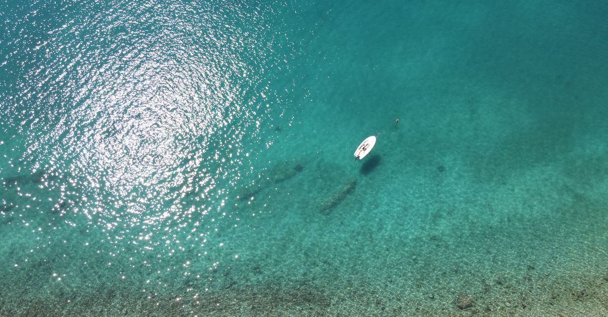
- August surface SST: ~26 °C northern Adriatic, ~27 °C southern[1]
- February surface SST (north): 9–11 °C, occasionally lower in bora-cooled Kvarner cells[1]
- Summer thermocline depth: typically 15–25 m; below it, 14–16 °C[1]
- Basin depth: the northern Adriatic averages ~35 m; southern basin exceeds 1,200 m[8]
- Freshwater input: significant from the Po (north) and Neretva (south) rivers[8]
The northern Adriatic behaves like a shallow shelf. It cools hard in winter, warms fast in summer, and gets a freshwater lid from continental river runoff. That last part matters for divers because the halocline near river mouths — the Neretva delta being the obvious case — can drop visibility to under 10 m even in July, when a site 30 km offshore is running 25 m of horizontal viz.
The southern basin, from about Split down to Dubrovnik, sits over much deeper water and behaves more like a normal Mediterranean regime: warmer year-round, more stable, less prone to the extreme winter cold snaps that hit the Kvarner Gulf.
The thermocline is the operational fact most guides ignore. In July and August, you leave a 26 °C surface, descend past a sharp visual shimmer at roughly 18–22 m, and land on a wreck at 15 °C. That's a 10 °C drop across two minutes of descent, and it decides your wetsuit.
Caveat: our SST figures are satellite-derived surface readings. We do not have systematic bottom-temperature measurements at depth on specific wrecks. Treat the exposure recommendations below as conservative starting points, not definitive.
⚓ The wrecks: what sank, where, and how deep
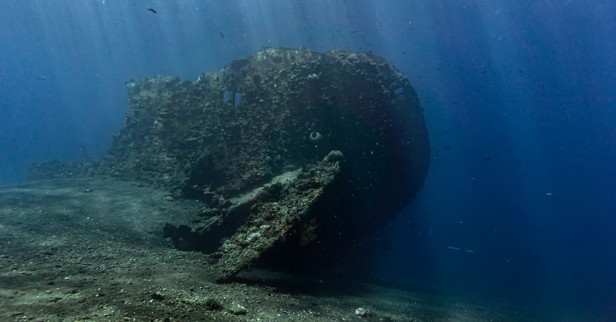
- Baron Gautsch max depth: ~42 m; shallowest deck ~28 m
- Sinking date: 13 August 1914 (Austro-Hungarian passenger steamer, hit a naval mine)
- Northern Adriatic wreck cluster: multiple documented sites in the Rovinj–Pula corridor
- Vis island cluster: WWII-era Italian and Allied wrecks within a ~10 km radius
- Certification floor: most named wrecks sit below 30 m — Advanced Open Water minimum, deep speciality preferred
The Baron Gautsch is the anchor of Croatian wreck diving for a reason: a 2,000-tonne passenger steamer sitting upright at 42 m, largely intact, with deck features shallow enough that Advanced Open Water divers can work the upper structure without pushing decompression limits. It is also a war grave — around 150 people died when it went down — and the local dive operator ethic reflects that.
The northern Adriatic offers a broader wreck inventory than most divers realise. The Rovinj–Pula corridor has a scatter of documented sites including Bucht Bobina and Bucht Mrzlanovica, which sit at more forgiving depths than the Baron Gautsch and work as bounce or training dives.
Vis, further south, is the density play. The island was a Yugoslav military zone until 1989 and stayed off the tourism circuit long enough that the surrounding wreck field is comparatively lightly dived. Operators like Big Blue Diving run the local sites, most of which sit in the 30–45 m range.
Our database records wreck existence, depth, and vessel type where documented. We do not record current internal structural condition. Any penetration dive should be planned with the local operator's current assessment — hulls corrode, silt shifts, entry points collapse.
🪨 Walls and drop-offs
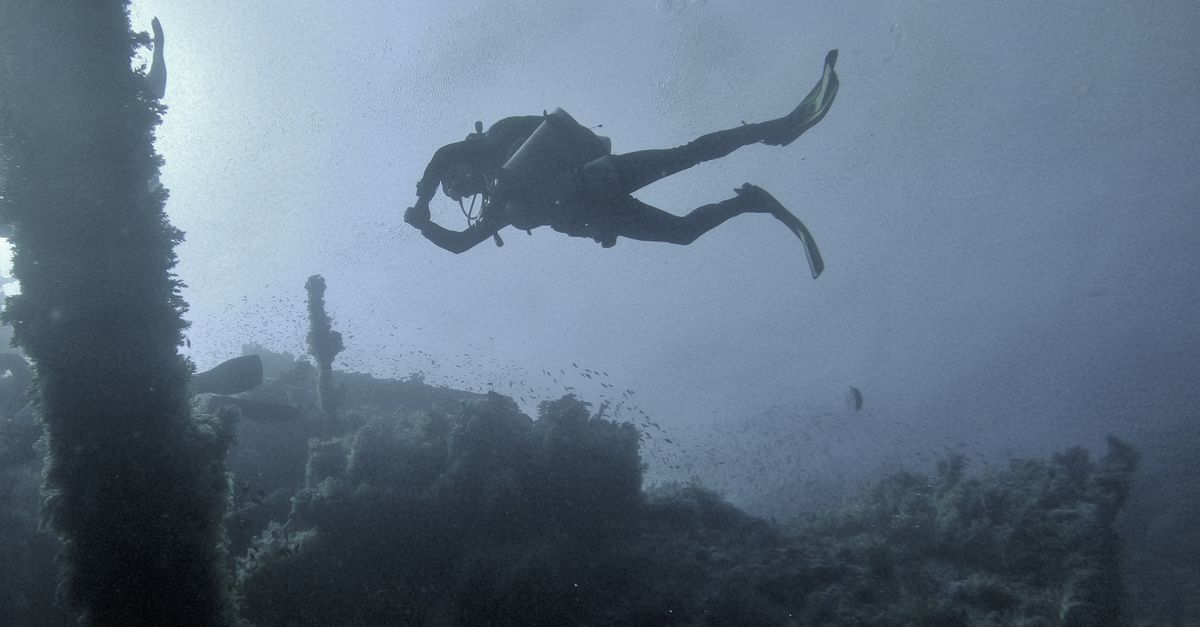
- Typical wall drop: 40–60 m along exposed Dalmatian island faces
- *Gorgonian (Eunicella cavolini*) band:** 25–45 m on shaded, north-facing walls[3]
- Posidonia meadows: 5–35 m on sandy slopes adjacent to walls[3]
- Structural origin: drowned karst — the islands are exposed limestone ridges
- Best light: late morning, when the sun angle reaches into the upper wall
The Dalmatian islands are the tops of a drowned karst ridge system. Underwater, this means walls: near-vertical limestone faces dropping 40–60 m, undercut with small caves, cracks, and ledges that hold gorgonians, sponges, and — where fishing pressure has been low — occasional grouper.
Canyon and Cutin are representative wall sites in our database. The dive profile is straightforward: descend along the wall face, work down to a chosen contour (typically 30 m for the gorgonian band), then ascend slowly along the same face, using the wall as a visual reference for your safety stop.
Honest characterisation: these walls are structurally interesting and biologically moderate. Fish biomass on a Croatian wall is not comparable to a Red Sea or Indo-Pacific equivalent. What Croatia offers is clear water, decent gorgonian cover in the 30–40 m band, and a landscape that rewards divers who enjoy geology as much as fauna. Guides that call these walls "spectacular" are usually not saying anything measurable.
OBIS records confirm gorgonian and Posidonia presence along the Dalmatian coast, but the density and health of specific colonies is not something our data can tell you at spot resolution.[3]
📅 The real season window
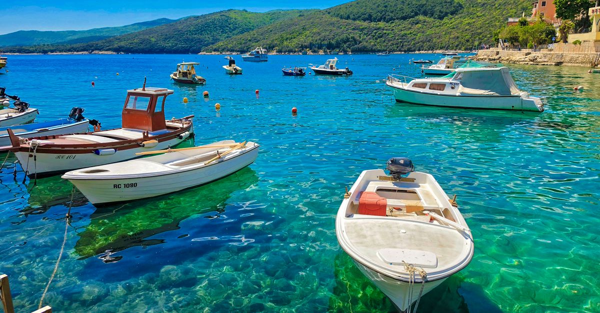
- February surface SST: 9–11 °C → drysuit[1]
- May surface SST: 17–19 °C → 7 mm wetsuit with hood[1]
- July–August surface: 25–27 °C surface, 14–16 °C below thermocline → 5–7 mm full[1]
- October surface SST: 19–21 °C, still very diveable[1]
- Bora frequency: 30–40 days/year of >50 km/h wind events in the Kvarner Gulf, mostly Oct–Mar[6][10]
The practical dive window runs May through October. Inside that window, there are two distinct regimes. May–June and September–October are what we would call the shoulder regime: surface temperatures in the high teens to low twenties, a weaker thermocline, and a 7 mm wetsuit with hood covering both surface and depth. July–August is the split regime: hot at the surface, cold below 20 m. Divers who wear a 3 mm because the surface reads 26 °C and then descend to a wreck at 15 °C are the reason chartered boats carry spare hoods.
Winter diving is possible but selective. Operators on Krk and around Rovinj do run drysuit dives through February, and visibility can actually be excellent — the summer algal signal drops out and the water clarifies. The limiting factor is not water temperature but the bora: a NE katabatic wind that funnels off the Velebit range and can hold boats in port for two to four days at a stretch. Open-Meteo historical wind data for the Kvarner Gulf shows the highest frequency of strong wind events between October and March.[6]
Open-Meteo wind data is modelled at grid-cell resolution. Actual bora funnelling through specific island channels — the Velebit Channel is the classic — can be significantly stronger than the grid average suggests. Local operators know the micro-geography; grid data does not.
🗺️ Four regions, four trade-offs

- Kvarner (Krk, Lošinj, Rab): closest to Zagreb; cooler year-round; wall and macro focus
- Šibenik / Murter: gateway to Kornati National Park; mixed wreck and wall
- Vis / Hvar: most remote by ferry (Split → Vis ~2.5 hrs); highest wreck density
- Dubrovnik (DBV): best international air access; shallowest sites; heaviest tourism
- Zadar (ZAD): underused gateway for northern Dalmatia and Dugi Otok
The four regions are not interchangeable. Kvarner, in the north, is closest to Zagreb by road and runs colder water for longer — the season shortens by roughly a month at each end compared to Dubrovnik. Banjol sits on Rab in this cluster, and CorrectDiving Krk is a representative operator.
Šibenik and Murter open onto the Kornati archipelago — an MPA that is genuinely worth the entry fee, but check current rules before you go. Aquanaut Diving Centar Murter is the operator anchor in our database. From Zadar, Božava Diving on Dugi Otok gives access to the northern Dalmatian sites with less transfer time than most Split-based itineraries.
Vis is the wreck-focused choice and also the most logistically demanding — a ferry crossing from Split adds roughly 2.5 hours each way, and off-season sailings drop to one or two per day. Dubrovnik is the easiest to reach internationally but has the shallowest sites and the highest tourist density in the water; for a first Croatian dive trip it works, but the diving is not the reason to fly to DBV specifically.
Our spot coverage is stronger for Krk, Murter, Vis, and Dugi Otok than for the immediate Dubrovnik area. The regional comparison here is partially asymmetric — take the Dubrovnik section as thinner data rather than a complete picture.
🐙 What actually lives there
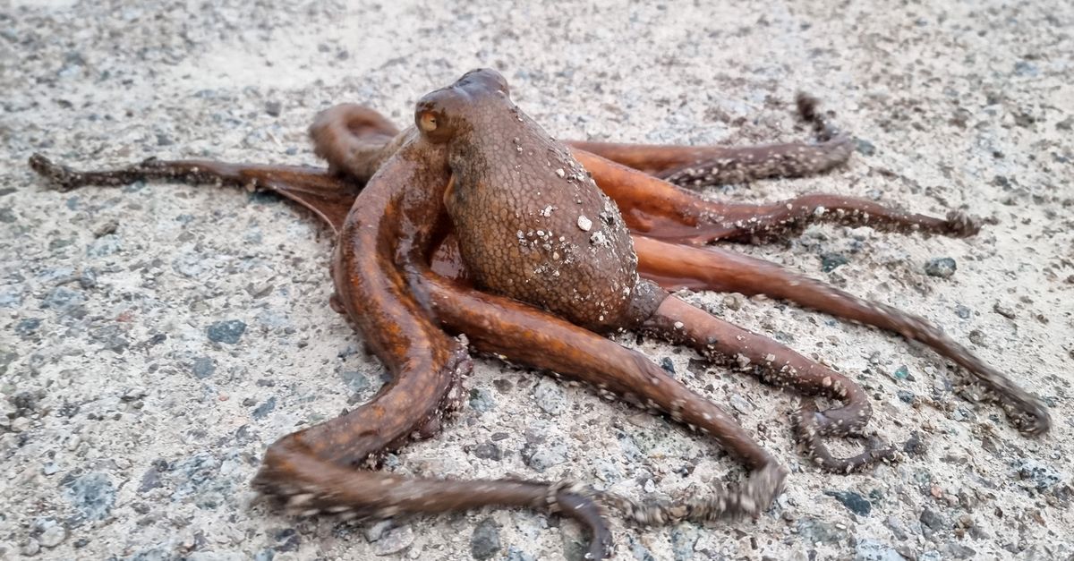
- Reliable sightings: common octopus (Octopus vulgaris), scorpionfish, moray, damselfish, nudibranchs[3]
- Occasional: dusky grouper (Epinephelus marginatus) — concentrated in Kornati and Mljet MPAs[3]
- Adriatic nudibranch diversity: ~40 species recorded[4]
- Functionally collapsed: Pinna nobilis — mass mortality event from 2016 parasite outbreak[8]
- Cetaceans: resident bottlenose dolphin population in Kvarner, rarely seen on dive[9]
The honest species list for a recreational dive in Croatia is: octopus, moray, scorpionfish, small wrasses, damselfish, the occasional cuttlefish, and — if you know how to look — a decent nudibranch inventory. OBIS records confirm all of these along the Dalmatian coast at accessible depths.[3]
Grouper are the marquee species most divers want to see, and they are heavily fished outside protected areas. Occurrence records cluster inside Kornati and Mljet national parks, where you have a realistic chance of a sighting.[3] Outside the MPAs, expect them to be rare and skittish.
The Pinna nobilis story is worth naming directly. The Mediterranean fan mussel was once a common sight in Croatian seagrass meadows. A haplosporidian parasite outbreak from 2016 onward collapsed populations across the Mediterranean, and Adriatic accessible-depth populations are now effectively gone.[8] What you see in older guidebooks — big fan mussels standing upright in Posidonia meadows — is not what you will see now.
OBIS and GBIF records are presence-only and biased toward research survey sites. Absence in the data does not equal absence in the water, and presence in the data does not tell you about current density.
✈️ Getting there without wasting a day on transfers
- Split (SPU): direct summer routes from London, Amsterdam, Frankfurt, Vienna, and dozens more[5]
- Dubrovnik (DBV): most international direct routes; heaviest summer congestion[5]
- Zadar (ZAD): fewer direct routes but faster access to Murter and Dugi Otok[5]
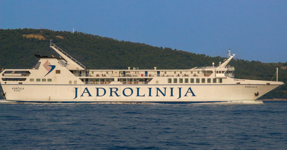
- Split → Vis ferry: Jadrolinija, ~2.5 hrs; 2–4 sailings/day in summer, 1–2 in winter
- Rijeka / Zagreb: road access to Kvarner (Krk connected by bridge)
OpenFlights route data shows Split and Dubrovnik carrying the bulk of international direct traffic in summer, with Zadar a distant third.[5] The routing logic that most first-time visitors miss: if you are going to Vis or Hvar, fly Split; if you are going to Dugi Otok or Murter, Zadar is often the faster option; if you are diving Krk, fly Zagreb and drive.
The ferry leg is the piece that flight-search tools do not surface. Split to Vis is roughly 2.5 hours by Jadrolinija ferry, and the schedule collapses in winter. Any Vis-based dive week planned around a Sunday arrival and Sunday departure can lose a full day to ferry timing if you don't check the sailing schedule before booking flights.
OpenFlights has a known update lag. Routes added or dropped in the last twelve months may not be reflected in the raw data. Verify directly with the airline before booking anything time-sensitive.
⚠️ What this list deliberately doesn't tell you
- Depth-specific temperature. Our SST is satellite-derived surface data. We can tell you what the top metre reads. We cannot tell you the exact temperature at 35 m on a specific wreck on a specific date. The thermocline behaviour we describe is a general summer pattern, not a dive-plan input.
- Visibility at spot resolution. We do not have systematic diver-reported visibility logs for every Croatian site. A bora event, a jellyfish bloom, or a summer algal pulse can cut visibility from 25 m to 5 m in under 48 hours. Call the local operator the week before you travel.
- Current MPA fees and permits. Kornati and Mljet require entry fees and operator licensing that change by season and by local authority. Our data records protection status but not the current fee schedule. Confirm with the park authority or your dive operator before assuming an itinerary is legal.
Spot a mistake, know a wreck we've mis-depthed, or have a bora anecdote that contradicts our numbers? Write to us at [email protected] — we correct in public, and diver-reported data is the only way our spot-level records get better.